


River Flood
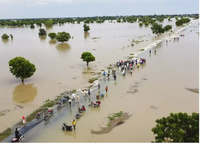
The number of flood events has increased significantly in sub-Saharan Africa, including many major urban centers and coastal areas. This has resulted in the death of thousands of people, the displacement of millions of people, and caused significant damage to many properties and farmlands worth of billions of dollars. Unfortunately, due to climate change, the occurrence of floods in ARC Member States has become more prominent in recent decades with an increasing frequency and trend of floods.
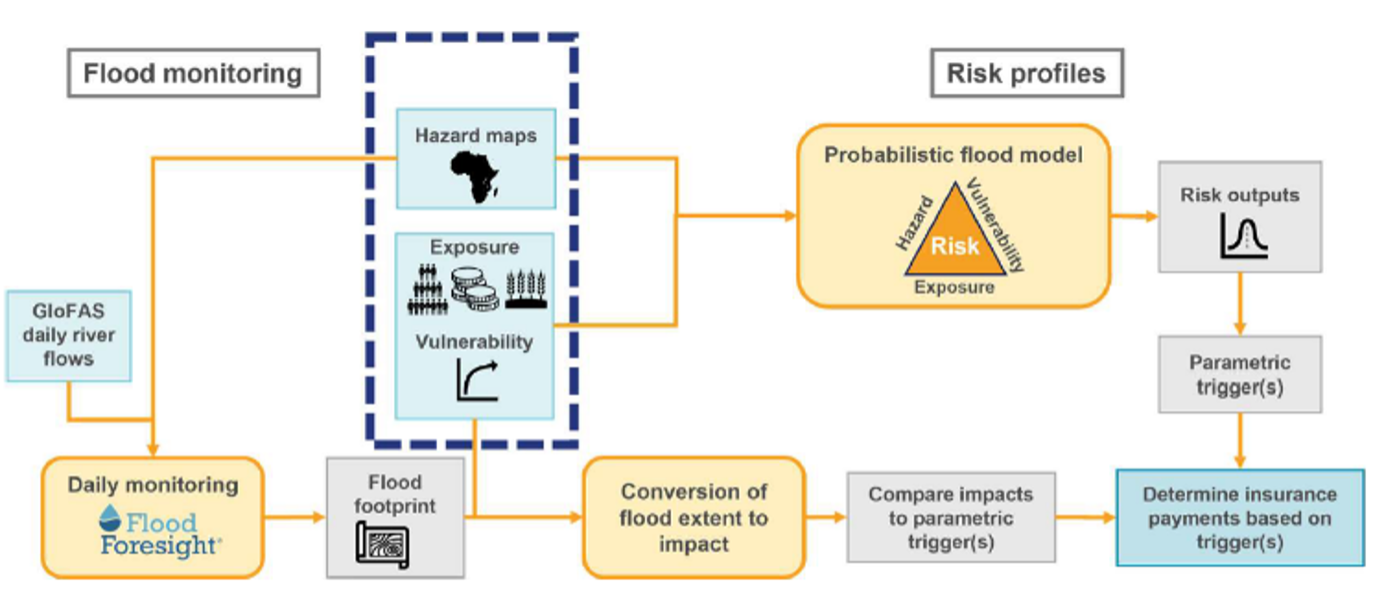
ARC Member States have expressed strong interest in the development and delivery by ARC of a flood insurance product to help countries respond timely to flood disasters. Although some regional and national initiatives exist in terms of flood early warning systems, there is no operational system going up to economic loss estimation to underpin a sovereign insurance scheme. Consequently, ARC partnered with JBA to propose a probabilistic approach to support the delivery of a practical and customizable parametric flood insurance product.
The objective of the proposed approach is to generate daily fluvial flood analysis for each country and calculate the associated impacts. The flood model outputs are presented in the form of standard risk metrics (people affected, economic losses, average annual loss, etc.) at different levels of spatial aggregation and for different types of exposure.
To support the delivery of disaster risk finance for flood impacts in ARC Member States, the modelling approach is implemented through four stages:
- Application of probabilistic catastrophe flood modelling to develop risk profiles for each country.
- Use of the probabilistic output to develop parametric insurance triggers.
- Daily monitoring and forecasting of flood events and impacts.
- Actions supporting countries with payments when parametric triggers are exceeded.
Global streamflow forecasts are used to monitor daily 10-day forecasts through the Global Flood Awareness System (GloFAS) jointly developed by the European Centre for Medium-Range Weather Forecasts (ECMWF) and the European Commission, to model inundation characteristics (flood extent and flood depth) and estimated impacts of flood (people affected and economic losses). These flood risk metrics are then used to inform parametric insurance thresholds and associated pricing.
The ARC Flood risk model was successfully reviewed and assessed on November 9-10, 2022 by a Technical Advisory Committee comprised of senior flood experts from world-renowned institutions. The Advisory Committee recognized that although the ARC Flood risk model addresses a very difficult problem, it is reasonably robust and efficient in terms of describing the risks associated with flood events. As a result, the ARC Flood risk model has been deemed ready to be used with confidence for underwriting flood insurance policy.
A dedicated interface, Flood Explorer (FLE), a web-based platform is was developed by ARC to provide easy access to the model data and visualization of flood characteristics. FLE can be accessed at https://fle.arc.int/.